
太魯閣 topographic map
Interactive map
Click on the map to display elevation.
About this map
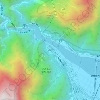
Name: 太魯閣 topographic map, elevation, terrain.
Location: 太魯閣, 富世村, 秀林鄉, Hualien, 臺灣省, 972, Taiwan (24.13210 121.60395 24.17210 121.64395)
Average elevation: 426 m
Minimum elevation: 17 m
Maximum elevation: 1,431 m