Geolocate

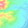
Guio-ang topographic map

Click on the map to display elevation.

About this map

Name: Guio-ang topographic map, elevation, terrain.

Location: Guio-ang, Guindulman, Bohol, Central Visayas, Philippines (9.77406 124.48922 9.80246 124.53009)

Average elevation: 58 m

Minimum elevation: -3 m

Maximum elevation: 310 m

Other topographic maps

Click on a map to view its topography, its elevation and its terrain.
Bunhayag Nature Park

Philippines > Bohol > Guindulman > Canhaway

Average elevation: 77 m

Gear up for your next adventure:

🎽Hiking Clothing - Breathable clothing for hiking
🧴SPF 50+ Bulk Sunscreen - Maximum protection for long-term outdoor exposure
🎽Base Layers - Thermal base layers
📕Hiking Guide Books - Guides for hiking trails
🔥Ferrocerium Rod Fire Starters - Reliable fire lighting in wet or windy conditions without matches

As an Amazon Associate, this site earns from qualifying purchases at no extra cost to you.