
el Llobregós topographic map
Interactive map
Click on the map to display elevation.
About this map
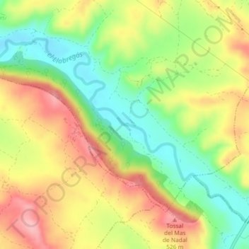
Name: el Llobregós topographic map, elevation, terrain.
Location: el Llobregós, Sanaüja, Segarra, Lérida, Cataluña, 25211, España (41.83585 1.30992 41.83587 1.31005)
Average elevation: 459 m
Minimum elevation: 392 m
Maximum elevation: 528 m