
Mangart topographic map
Click on the map to display elevation.
Mangart
Mangart or Mangrt is a mountain in the Julian Alps, located on the border between Italy and Slovenia. With an elevation of 2,679 metres (8,789 ft), it is the fourth-highest peak in Slovenia, after Triglav, Škrlatica and Mali Triglav. It was first climbed in 1794 by the naturalist Franz von Hohenwart. Mangart is also the name of the mountain range between the Koritnica Valley and the Mangart Valley, with the highest peak called Veliki Mangart (Big Mount Mangart).
About this map
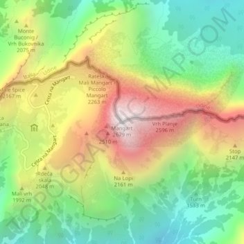
Name: Mangart topographic map, elevation, terrain.
Location: Mangart, Bovec, Slovenia (46.43942 13.65462 46.43952 13.65472)
Average elevation: 1,800 m
Minimum elevation: 1,180 m
Maximum elevation: 2,663 m