
Thank you for supporting this site ❤️
Make a donation
Make a donation
Gear up for your next adventure:
As an Amazon Associate, this site earns from qualifying purchases at no extra cost to you.
Staffalo topographic map
Click on the map to display elevation.
Thank you for supporting this site ❤️
Make a donation
Make a donation
Gear up for your next adventure:
As an Amazon Associate, this site earns from qualifying purchases at no extra cost to you.
About this map
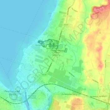
Name: Staffalo topographic map, elevation, terrain.
Location: Staffalo, Castelnuovo del Garda, Verona, Veneto, 37014, Italy (45.43271 10.69421 45.47271 10.73421)
Average elevation: 86 m
Minimum elevation: 62 m
Maximum elevation: 134 m
Thank you for supporting this site ❤️
Make a donation
Make a donation
Gear up for your next adventure:
As an Amazon Associate, this site earns from qualifying purchases at no extra cost to you.