
Acandí topographic map
Interactive map
Click on the map to display elevation.
About this map
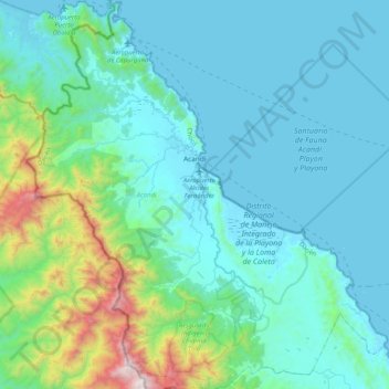
Name: Acandí topographic map, elevation, terrain.
Location: Acandí, Darién, Chocó, 278017, Colômbia (8.27005 -77.45636 8.67737 -77.07503)
Average elevation: 235 m
Minimum elevation: -1 m
Maximum elevation: 1,666 m
Other topographic maps
Click on a map to view its topography, its elevation and its terrain.