
Paradise Port topographic map
Interactive map
Click on the map to display elevation.
About this map
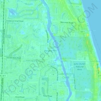
Name: Paradise Port topographic map, elevation, terrain.
Average elevation: 6 m
Minimum elevation: -2 m
Maximum elevation: 21 m
Other topographic maps
Click on a map to view its topography, its elevation and its terrain.
Jupiter
États-Unis d'Amérique > Floride > Palm Beach County
Jupiter, Palm Beach County, Floride, 33458, États-Unis d'Amérique
Average elevation: 4 m
Palm Springs
États-Unis d'Amérique > Floride > Palm Beach County
Palm Springs, Palm Beach County, Floride, 22400, États-Unis d'Amérique
Average elevation: 9 m
West Palm Beach
États-Unis d'Amérique > Floride > Palm Beach County > West Palm Beach
West Palm Beach, Palm Beach County, Floride, États-Unis d'Amérique
Average elevation: 4 m