
Île Eagle topographic map
Interactive map
Click on the map to display elevation.
About this map
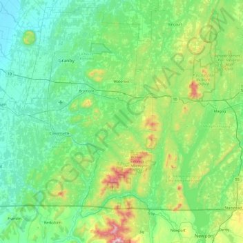
Name: Île Eagle topographic map, elevation, terrain.
Average elevation: 230 m
Minimum elevation: 30 m
Maximum elevation: 1,116 m
Other topographic maps
Click on a map to view its topography, its elevation and its terrain.
West Brome
Canada > Québec > Lac-Brome > West Brome
West Brome, Lac-Brome, Brome-Missisquoi, Montérégie, Québec, J0E 2P0, Canada
Average elevation: 162 m
Baie Rock Island
Baie Rock Island, Lac-Brome, Brome-Missisquoi, Montérégie, Québec, J0E 1R0, Canada
Average elevation: 201 m