
Berrac topographic map
Interactive map
Click on the map to display elevation.
About this map
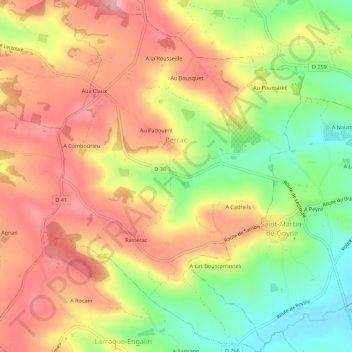
Name: Berrac topographic map, elevation, terrain.
Average elevation: 153 m
Minimum elevation: 70 m
Maximum elevation: 221 m
Other topographic maps
Click on a map to view its topography, its elevation and its terrain.
Monclar-sur-Losse
Monclar-sur-Losse, Mirande, Gers, Occitania, Francia metropolitana, 32300, Francia
Average elevation: 211 m