Geolocate

Sangandaan topographic map

Click on the map to display elevation.

About this map
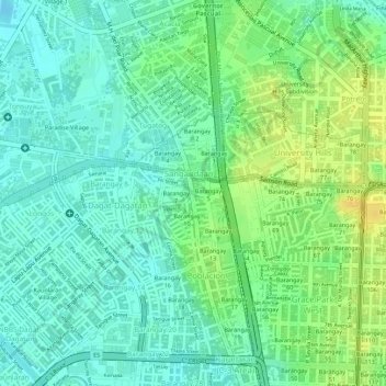
Name: Sangandaan topographic map, elevation, terrain.

Location: Sangandaan, District 1, Caloocan, Northern Manila District, Metro Manila, Philippines (14.65105 120.96746 14.66214 120.97494)

Average elevation: 11 m

Minimum elevation: -3 m

Maximum elevation: 27 m

Other topographic maps

Click on a map to view its topography, its elevation and its terrain.

Caybiga

Philippines > Caloocan

Average elevation: 38 m

Caybiga

Philippines > Caloocan

Average elevation: 38 m

Caybiga

Philippines > Caloocan

Average elevation: 38 m

Gear up for your next adventure:

🎽Hiking Clothing - Breathable clothing for hiking
🥾Hiking Shoes - Lightweight hiking shoes for day hikes
👕UPF 50+ Sun Shirts - Essential protection against the harsh Australian sun during field work
🥤Outdoor Water Bottles - Reusable bottles for outdoor activities
🎒Ultralight Backpacks - Lightweight packs for long hikes

As an Amazon Associate, this site earns from qualifying purchases at no extra cost to you.