
Thank you for supporting this site ❤️
Make a donation
Make a donation
Gear up for your next adventure:
As an Amazon Associate, this site earns from qualifying purchases at no extra cost to you.
Xingjiang topographic map
Click on the map to display elevation.
Thank you for supporting this site ❤️
Make a donation
Make a donation
Gear up for your next adventure:
As an Amazon Associate, this site earns from qualifying purchases at no extra cost to you.
About this map
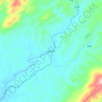
Name: Xingjiang topographic map, elevation, terrain.
Location: Xingjiang, Xingguo County, Ganzhou, Jiangxi, China (26.45323 115.73333 26.53323 115.81333)
Average elevation: 377 m
Minimum elevation: 247 m
Maximum elevation: 1,011 m
Thank you for supporting this site ❤️
Make a donation
Make a donation
Gear up for your next adventure:
As an Amazon Associate, this site earns from qualifying purchases at no extra cost to you.