
El Cedral topographic map
Interactive map
Click on the map to display elevation.
About this map
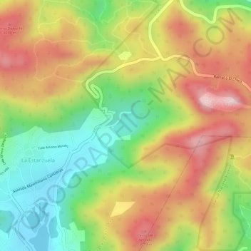
Name: El Cedral topographic map, elevation, terrain.
Location: El Cedral, La Estanzuela, Mineral del Chico, Hidalgo, México (20.18136 -98.74780 20.18387 -98.74507)
Average elevation: 2,897 m
Minimum elevation: 2,737 m
Maximum elevation: 3,047 m