Geolocate

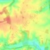
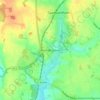
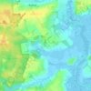
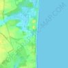
Iken topographic map

Click on the map to display elevation.

About this map

Name: Iken topographic map, elevation, terrain.

Location: Iken, East Suffolk, Suffolk, England, United Kingdom (52.12403 1.49219 52.16109 1.57664)

Average elevation: 9 m

Minimum elevation: -4 m

Maximum elevation: 26 m

Other topographic maps

Click on a map to view its topography, its elevation and its terrain.
Hinton

United Kingdom > England > Suffolk > East Suffolk > Blythburgh

Average elevation: 19 m

Hulver Street

United Kingdom > England > Suffolk > East Suffolk

Average elevation: 16 m

Sibton Green

United Kingdom > England > Suffolk > East Suffolk

Average elevation: 35 m

Sweffling

United Kingdom > England > Suffolk > East Suffolk

Average elevation: 32 m

Thorpeness

United Kingdom > England > Suffolk > East Suffolk

Average elevation: 4 m

Eastbridge

United Kingdom > England > Suffolk > East Suffolk

Average elevation: 10 m

Benhall Green

United Kingdom > England > Suffolk > East Suffolk

Average elevation: 21 m

Henstead

United Kingdom > England > Suffolk > East Suffolk

Average elevation: 13 m

Somerleyton

United Kingdom > England > Suffolk > East Suffolk

Average elevation: 9 m

Butley Abbey

United Kingdom > England > Suffolk > East Suffolk > Butley

Average elevation: 9 m

Kelsale

United Kingdom > England > Suffolk > East Suffolk

Average elevation: 32 m

Wangford

United Kingdom > England > Suffolk > East Suffolk

Average elevation: 13 m

Wenhaston

United Kingdom > England > Suffolk > East Suffolk

Average elevation: 16 m

Thorpeness

United Kingdom > England > Suffolk > East Suffolk

Average elevation: 4 m

Wangford

United Kingdom > England > Suffolk > East Suffolk

Average elevation: 13 m

Sizewell

United Kingdom > England > Suffolk > East Suffolk > Leiston

Average elevation: 5 m

Sweffling

United Kingdom > England > Suffolk > East Suffolk

Average elevation: 32 m

Wangford

United Kingdom > England > Suffolk > East Suffolk

Average elevation: 13 m

Sizewell

United Kingdom > England > Suffolk > East Suffolk > Leiston

Average elevation: 5 m

Gear up for your next adventure:

🖼️Scratch-off Australia Map - Track the regions and peaks you have explored geographically
🌬️Windbreaker Jackets - Wind protection jackets
📟Satellite Messengers - Two-way satellite communication to stay in touch beyond the cellular grid
🧊Insulated Stainless Steel Flasks - Keep water cold for 24 hours in the heat or coffee hot in the cold
📻Handheld UHF Radios - Critical communication for groups in the Australian outback

As an Amazon Associate, this site earns from qualifying purchases at no extra cost to you.