Geolocate

Parbold topographic map

Click on the map to display elevation.

About this map

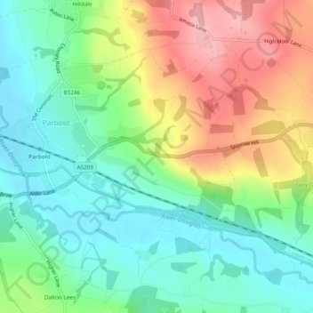
Name: Parbold topographic map, elevation, terrain.

Location: Parbold, West Lancashire, Lancashire, England, United Kingdom (53.57958 -2.77770 53.60075 -2.73012)

Average elevation: 62 m

Minimum elevation: 9 m

Maximum elevation: 147 m

Gear up for your next adventure:

🕯️Emergency Whistles - Safety whistles for hiking
🔋Solar Power Banks - Charge your phone and GPS using the sun while deep in the bush
🩹Blister Prevention Tape - Apply to friction points before they become painful sores
🔋Solar Power Banks - Solar chargers for outdoors
📡Satellite Messengers - Emergency communication devices

As an Amazon Associate, this site earns from qualifying purchases at no extra cost to you.