
東勢里 topographic map
Interactive map
Click on the map to display elevation.
About this map
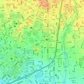
Name: 東勢里 topographic map, elevation, terrain.
Location: 東勢里, 東區, Taichung, 401, Taïwan (24.14413 120.69037 24.15205 120.69441)
Average elevation: 97 m
Minimum elevation: 71 m
Maximum elevation: 122 m
Other topographic maps
Click on a map to view its topography, its elevation and its terrain.