Geolocate

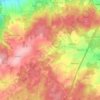
Börthen topographic map

Click on the map to display elevation.

About this map

Name: Börthen topographic map, elevation, terrain.

Location: Börthen, Neustadt an der Orla, Saale-Orla-Kreis, Thüringen, 07806, Deutschland (50.72239 11.71801 50.76239 11.75801)

Average elevation: 326 m

Minimum elevation: 266 m

Maximum elevation: 424 m

Other topographic maps

Click on a map to view its topography, its elevation and its terrain.
Gear up for your next adventure:

🚁Camera Drones with GPS - Capture aerial views of the landscape to compare with topo maps
🩹First Aid Kits - Emergency kits for hiking
🧊Insulated Cooler Bags - Keep food fresh for day trips to remote geographic sites
🧊Insulated Stainless Steel Flasks - Keep water cold for 24 hours in the heat or coffee hot in the cold
📦Crushproof Equipment Cases - Safe transport for sensitive surveying and mapping instruments

As an Amazon Associate, this site earns from qualifying purchases at no extra cost to you.