
Saltwater River topographic map
Interactive map
Click on the map to display elevation.
About this map
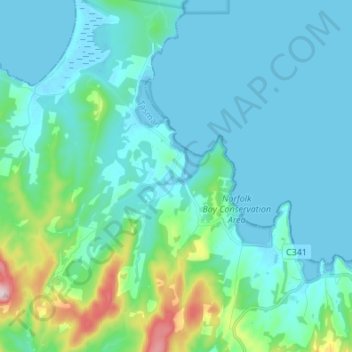
Name: Saltwater River topographic map, elevation, terrain.
Location: Saltwater River, Tasman, Tasmania, Australia (-43.07494 147.67006 -42.97572 147.74572)
Average elevation: 50 m
Minimum elevation: -1 m
Maximum elevation: 339 m
Tasmania trails, hiking, mountain biking, running and outdoor activities
Other topographic maps
Click on a map to view its topography, its elevation and its terrain.