
Thank you for supporting this site ❤️
Make a donation
Make a donation
Gear up for your next adventure:
As an Amazon Associate, this site earns from qualifying purchases at no extra cost to you.
Hetauda topographic map
Click on the map to display elevation.
Thank you for supporting this site ❤️
Make a donation
Make a donation
Gear up for your next adventure:
As an Amazon Associate, this site earns from qualifying purchases at no extra cost to you.
About this map
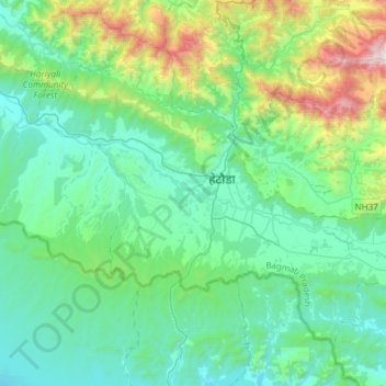
Name: Hetauda topographic map, elevation, terrain.
Location: Hetauda, Makwanpur, Bagmati Pradesh, Nepal (27.31241 84.88848 27.52573 85.18743)
Average elevation: 701 m
Minimum elevation: 269 m
Maximum elevation: 2,430 m
Thank you for supporting this site ❤️
Make a donation
Make a donation
Gear up for your next adventure:
As an Amazon Associate, this site earns from qualifying purchases at no extra cost to you.