
Reuken topographic map
Interactive map
Click on the map to display elevation.
About this map
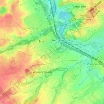
Name: Reuken topographic map, elevation, terrain.
Location: Reuken, Nuth, Beekdaelen, Limburg, Nederland, 6361 AL, Nederland (50.89302 5.86953 50.93302 5.90953)
Average elevation: 94 m
Minimum elevation: 61 m
Maximum elevation: 131 m
Other topographic maps
Click on a map to view its topography, its elevation and its terrain.