
Ucum topographic map
Interactive map
Click on the map to display elevation.
About this map
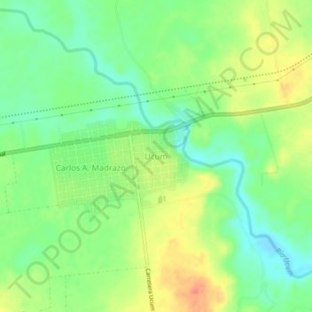
Name: Ucum topographic map, elevation, terrain.
Location: Ucum, Othón P. Blanco, Quintana Roo, Mexique (18.48288 -88.53874 18.52288 -88.49874)
Average elevation: 25 m
Minimum elevation: 3 m
Maximum elevation: 51 m
Other topographic maps
Click on a map to view its topography, its elevation and its terrain.
Chetumal
Mexique > Quintana Roo > Othón P. Blanco > Chetumal
Chetumal, Othón P. Blanco, Quintana Roo, Mexique
Average elevation: 6 m