
Курдым topographic map
Interactive map
Click on the map to display elevation.
About this map
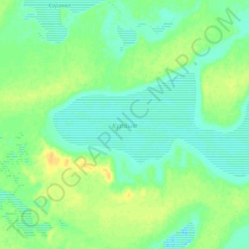
Name: Курдым topographic map, elevation, terrain.
Location: Курдым, Иргизский район, Актюбинская область, Казахстан (47.95335 62.90145 47.99526 63.04998)
Average elevation: 56 m
Minimum elevation: 48 m
Maximum elevation: 69 m
Other topographic maps
Click on a map to view its topography, its elevation and its terrain.
Иргиз
Казахстан > Актюбинская область > Иргизский район
Иргиз, Иргизский район, Актюбинская область, 030400, Казахстан
Average elevation: 102 m