
Thank you for supporting this site ❤️
Make a donation
Make a donation
Gear up for your next adventure:
As an Amazon Associate, this site earns from qualifying purchases at no extra cost to you.
Midvale topographic map
Click on the map to display elevation.
Thank you for supporting this site ❤️
Make a donation
Make a donation
Gear up for your next adventure:
As an Amazon Associate, this site earns from qualifying purchases at no extra cost to you.
About this map
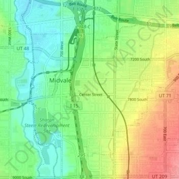
Name: Midvale topographic map, elevation, terrain.
Location: Midvale, Salt Lake County, Utah, 84047, United States (40.59374 -111.92141 40.63085 -111.85577)
Average elevation: 1,335 m
Minimum elevation: 1,302 m
Maximum elevation: 1,386 m
Thank you for supporting this site ❤️
Make a donation
Make a donation
Gear up for your next adventure:
As an Amazon Associate, this site earns from qualifying purchases at no extra cost to you.