
Curhuas topographic map
Interactive map
Click on the map to display elevation.
About this map
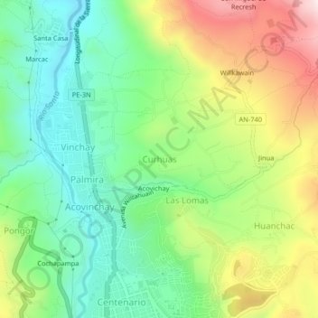
Name: Curhuas topographic map, elevation, terrain.
Average elevation: 3,155 m
Minimum elevation: 2,936 m
Maximum elevation: 3,520 m
Other topographic maps
Click on a map to view its topography, its elevation and its terrain.
Acovichay
Perú > Áncash > Independencia > Curhuas
Acovichay, Curhuas, Independencia, Huaraz, Áncash, 02690, Perú
Average elevation: 3,144 m