Geolocate

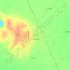
Sweeny topographic map

Click on the map to display elevation.

About this map

Name: Sweeny topographic map, elevation, terrain.

Location: Sweeny, Brazoria County, Texas, 77480, United States (29.03312 -95.72289 29.06431 -95.67971)

Average elevation: 10 m

Minimum elevation: 3 m

Maximum elevation: 14 m

Other topographic maps

Click on a map to view its topography, its elevation and its terrain.
Rosharon

United States > Texas > Brazoria County

Average elevation: 16 m

Damon

United States > Texas > Brazoria County

Average elevation: 25 m

Damon Mound

United States > Texas > Brazoria County > Damon

Average elevation: 28 m

Rosharon

United States > Texas > Brazoria County

Average elevation: 16 m

Meridiana

United States > Texas > Brazoria County > Iowa Colony

Average elevation: 16 m

Damon

United States > Texas > Brazoria County

Average elevation: 25 m

Gear up for your next adventure:

🧥Insulated Down Jackets - High warmth-to-weight ratio for cold nights in the high country
🦯Adjustable Trekking Poles - Reduce impact on knees when descending steep topographic ridges
💡Collapsible Camping Lanterns - Illuminate your base camp or tent for map studying at night
🏕️Camping Gear - Essential camping equipment
⛺Lightweight Tents - Compact tents for backpacking

As an Amazon Associate, this site earns from qualifying purchases at no extra cost to you.