
Make a donation
Gear up for your next adventure:
As an Amazon Associate, this site earns from qualifying purchases at no extra cost to you.
Kaleybar topographic map
Click on the map to display elevation.
Make a donation
Gear up for your next adventure:
As an Amazon Associate, this site earns from qualifying purchases at no extra cost to you.
Kaleybar
The relatively well preserved Babak Castle at an altitude of 2300 m is located is located some 3 km of the town. This Sasanid era fortress is named after the ninth century Iranian resistance leader, Babak Khorramdin., who resisted Arab armies until year 839.
Make a donation
Gear up for your next adventure:
As an Amazon Associate, this site earns from qualifying purchases at no extra cost to you.
About this map
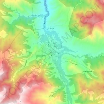
Name: Kaleybar topographic map, elevation, terrain.
Average elevation: 1,457 m
Minimum elevation: 946 m
Maximum elevation: 2,208 m
Make a donation
Gear up for your next adventure:
As an Amazon Associate, this site earns from qualifying purchases at no extra cost to you.