
Morotai Island topographic map
Interactive map
Click on the map to display elevation.
About this map
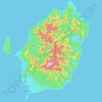
Name: Morotai Island topographic map, elevation, terrain.
Location: Morotai Island, Pulau Morotai, North Maluku, Maluku, Indonesia (1.98057 128.19722 2.64525 128.69377)
Average elevation: 114 m
Minimum elevation: -1 m
Maximum elevation: 1,171 m