Geolocate

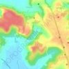
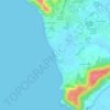
Sangolda topographic map

Click on the map to display elevation.

About this map

Name: Sangolda topographic map, elevation, terrain.

Location: Sangolda, Bardez, North Goa, Goa, 403501, India (15.52543 73.79142 15.56543 73.83142)

Average elevation: 30 m

Minimum elevation: -1 m

Maximum elevation: 83 m

Other topographic maps

Click on a map to view its topography, its elevation and its terrain.
Anjuna

India > Goa > Bardez > Vagator

Average elevation: 12 m

Pilerne Lake

India > Goa > Bardez > Sangolda

Average elevation: 39 m

Corjuem Fort

India > Goa > Bardez > Corjuem

Average elevation: 13 m

Aguada Fort

India > Goa > Bardez > Sinquerim

Average elevation: 8 m

Anjuna

India > Goa > Bardez

Average elevation: 13 m

Anjuna Beach

India > Goa > Bardez > Anjuna

Average elevation: 10 m

Chapora Fort

India > Goa > Bardez > Chapora

Average elevation: 8 m

Gear up for your next adventure:

🔋Solar Power Banks - Charge your phone and GPS using the sun while deep in the bush
🧢Wide Brim Sun Hats - Maximum coverage for the face and neck while out in the open
👄SPF Lip Balm - Prevent sun and wind-burnt lips on mountain ridges
🥤Hydration Packs - Hydration systems for hiking
🛌Sleeping Mats - Insulated mats for camping comfort

As an Amazon Associate, this site earns from qualifying purchases at no extra cost to you.