
Sengkol topographic map
Interactive map
Click on the map to display elevation.
About this map
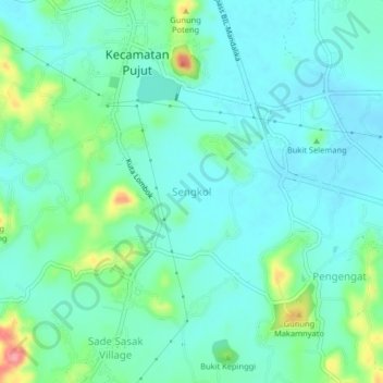
Name: Sengkol topographic map, elevation, terrain.
Average elevation: 113 m
Minimum elevation: 91 m
Maximum elevation: 187 m
Other topographic maps
Click on a map to view its topography, its elevation and its terrain.
Kuta
Indonesia > West Nusa Tenggara > Lombok Tengah
Kuta, Lombok Tengah, West Nusa Tenggara, Lesser Sunda Islands, 83573, Indonesia
Average elevation: 34 m
Merendeng
Indonesia > West Nusa Tenggara > Lombok Tengah > Prabu
Merendeng, Prabu, Lombok Tengah, West Nusa Tenggara, Lesser Sunda Islands, 83573, Indonesia
Average elevation: 83 m