
Mañazo topographic map
Interactive map
Click on the map to display elevation.
About this map
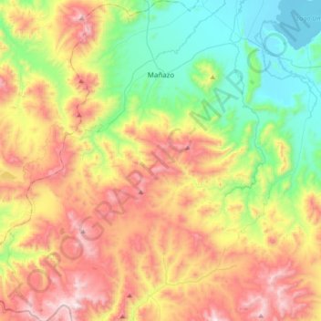
Name: Mañazo topographic map, elevation, terrain.
Location: Mañazo, Puno, Perú (-16.05037 -70.56289 -15.72613 -70.29109)
Average elevation: 4,318 m
Minimum elevation: 3,834 m
Maximum elevation: 5,001 m