Geolocate

Morland topographic map

Click on the map to display elevation.

About this map

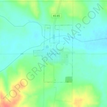
Name: Morland topographic map, elevation, terrain.

Location: Morland, Graham County, Kansas, 67650, United States (39.34219 -100.08225 39.35667 -100.06945)

Average elevation: 715 m

Minimum elevation: 698 m

Maximum elevation: 755 m

Other topographic maps

Click on a map to view its topography, its elevation and its terrain.

Saint Peter

United States > Kansas > Graham County

Average elevation: 758 m

Gear up for your next adventure:

👖Convertible Hiking Trousers - Zip-off legs to adapt to changing temperatures throughout the day
🌬️Windbreaker Jackets - Wind protection jackets
🧊Insulated Cooler Bags - Keep food fresh for day trips to remote geographic sites
Altimeter Barometer Watches - Outdoor watches with built-in sensors to track altitude changes and weather shifts
🧺Fast-Dry Microfiber Towels - Large towels that pack down to the size of an orange

As an Amazon Associate, this site earns from qualifying purchases at no extra cost to you.