
Buissenal topographic map
Interactive map
Click on the map to display elevation.
About this map
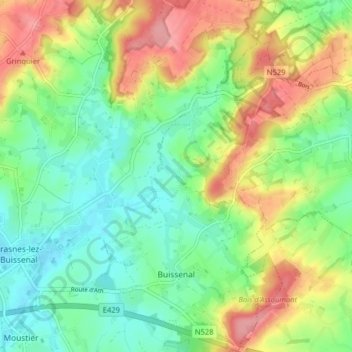
Name: Buissenal topographic map, elevation, terrain.
Location: Buissenal, Frasnes-lez-Anvaing, Ath, Hainaut, Wallonie, Belgique (50.65376 3.63904 50.70426 3.67981)
Average elevation: 74 m
Minimum elevation: 32 m
Maximum elevation: 140 m