
Black Springs topographic map
Interactive map
Click on the map to display elevation.
About this map
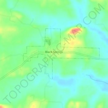
Name: Black Springs topographic map, elevation, terrain.
Average elevation: 228 m
Minimum elevation: 211 m
Maximum elevation: 264 m
Other topographic maps
Click on a map to view its topography, its elevation and its terrain.
Mount Ida
United States > Arkansas > Montgomery County
Mount Ida, Montgomery County, Arkansas, United States
Average elevation: 215 m
Mount Ida
United States > Arkansas > Montgomery County > Mount Ida
Mount Ida, Montgomery County, Arkansas, United States
Average elevation: 215 m