
由良/大栄 topographic map
Interactive map
Click on the map to display elevation.
About this map
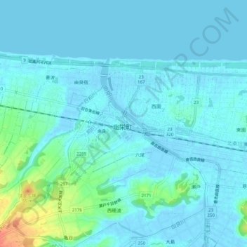
Name: 由良/大栄 topographic map, elevation, terrain.
Location: 由良/大栄, 北栄町, 東伯郡, Prefectura de Tottori, 6892201, Japón (35.47040 133.73883 35.51040 133.77883)
Average elevation: 7 m
Minimum elevation: -4 m
Maximum elevation: 48 m