
Pampas Grande topographic map
Interactive map
Click on the map to display elevation.
About this map
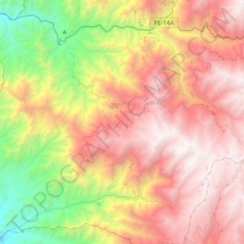
Name: Pampas Grande topographic map, elevation, terrain.
Location: Pampas Grande, Provincia de Huaraz, Áncash, Perú (-9.77292 -78.04189 -9.53102 -77.76940)
Average elevation: 2,765 m
Minimum elevation: 686 m
Maximum elevation: 4,720 m
Other topographic maps
Click on a map to view its topography, its elevation and its terrain.
Pampas Grande
Perú > Áncash > Pampas Grande
Pampas Grande, Huaraz, Áncash, Perú
Average elevation: 3,663 m