
Sietes topographic map
Interactive map
Click on the map to display elevation.
About this map
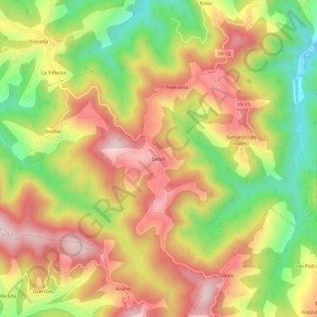
Name: Sietes topographic map, elevation, terrain.
Location: Sietes, Villaviciosa, Asturias, 33310, España (43.41293 -5.38717 43.45293 -5.34717)
Average elevation: 304 m
Minimum elevation: 90 m
Maximum elevation: 491 m
Other topographic maps
Click on a map to view its topography, its elevation and its terrain.
Selorio
España > Asturias > Villaviciosa
Selorio, Villaviciosa, Asturias, 33317, España
Average elevation: 65 m