Geolocate

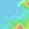
Simpocan topographic map

Click on the map to display elevation.

About this map

Name: Simpocan topographic map, elevation, terrain.

Location: Simpocan, Puerto Princesa, Mimaropa, Philippines (9.78838 118.53181 9.82838 118.57181)

Average elevation: 83 m

Minimum elevation: 0 m

Maximum elevation: 549 m

Other topographic maps

Click on a map to view its topography, its elevation and its terrain.

Baywalk Park

Philippines > Puerto Princesa

Average elevation: 6 m

Bacungan River

Philippines > Puerto Princesa

Average elevation: 123 m

Irawan River

Philippines > Puerto Princesa

Average elevation: 120 m

Tagkawayan Beach

Philippines > Puerto Princesa

Average elevation: 48 m

Sabang River

Philippines > Puerto Princesa

Average elevation: 39 m

Manors Verdant

Philippines > Puerto Princesa

Average elevation: 5 m

Gear up for your next adventure:

🔪Outdoor Multi-tools - Versatile tools for gear repair and survival tasks in the wilderness
🛠️Outdoor Repair Kits - Gear repair kits
🕶️Polarized Sunglasses - UV protection sunglasses for outdoors
🧦Hiking Socks - Comfortable socks for long hikes
🆘Personal Locator Beacons (PLB) - Satellite emergency beacons for life-saving help in areas with no mobile coverage

As an Amazon Associate, this site earns from qualifying purchases at no extra cost to you.