
Zeboudja topographic map
Interactive map
Click on the map to display elevation.
About this map
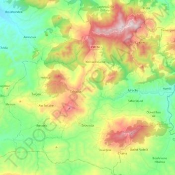
Name: Zeboudja topographic map, elevation, terrain.
Location: Zeboudja, Daïra Zeboudja, Asch-Schalif, Algerien (36.30541 1.37612 36.47534 1.54616)
Average elevation: 491 m
Minimum elevation: 106 m
Maximum elevation: 1,130 m