

Loreto topographic map
Click on the map to display elevation.
Loreto
Loreto is located on the east coast of the Baja California Peninsula, at 26º00'46" N 111º20'36" W. It is bordered on the east by the Gulf of California, on the west by the Transpeninsular Highway, and on the south by the Arroyo Loreto, a dry creek bed that only fills with water after a heavy rainfall. The city is built on relatively flat land with an average elevation is 10 meters (33 ft) above sea level. "La Giganta" Mountain Range ("Sierra de la Giganta") lies to the west, extending along the center of the state of Baja California Sur, parallel to the gulf coast.
About this map
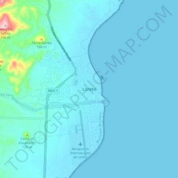
Name: Loreto topographic map, elevation, terrain.
Average elevation: 22 m
Minimum elevation: -1 m
Maximum elevation: 313 m
Other topographic maps
Click on a map to view its topography, its elevation and its terrain.
