
Favone topographic map
Interactive map
Click on the map to display elevation.
About this map
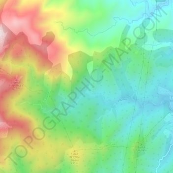
Name: Favone topographic map, elevation, terrain.
Average elevation: 251 m
Minimum elevation: 0 m
Maximum elevation: 701 m
Other topographic maps
Click on a map to view its topography, its elevation and its terrain.
Punta di l'Oru
France > Corse > Corse-du-Sud > Sari-Solenzara
Punta di l'Oru, Sari-Solenzara, Sartène, Corse-du-Sud, Corse, France métropolitaine, 20145, France
Average elevation: 47 m