
Massif de la Vanoise topographic map
Interactive map
Click on the map to display elevation.
About this map
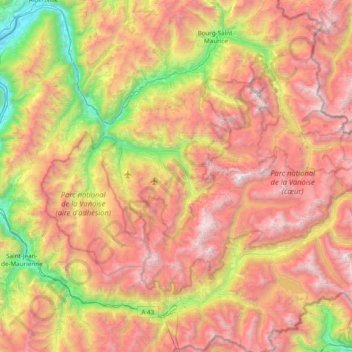
Name: Massif de la Vanoise topographic map, elevation, terrain.
Average elevation: 1,989 m
Minimum elevation: 301 m
Maximum elevation: 3,793 m
Other topographic maps
Click on a map to view its topography, its elevation and its terrain.
Courchevel 1850
France > Auvergne-Rhône-Alpes > Courchevel > Courchevel 1850
Courchevel 1850, Saint-Bon-Tarentaise, Courchevel, Albertville, Savoie, Auvergne-Rhône-Alpes, France métropolitaine, 73120, France
Average elevation: 1,714 m