
Cleveland topographic map
Interactive map
Click on the map to display elevation.
About this map
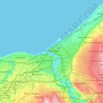
Name: Cleveland topographic map, elevation, terrain.
Location: Cleveland, Cuyahoga County, Ohio, Estados Unidos da América (41.39063 -81.87909 41.60444 -81.53274)
Average elevation: 215 m
Minimum elevation: 171 m
Maximum elevation: 356 m