
Houtaing topographic map
Interactive map
Click on the map to display elevation.
About this map
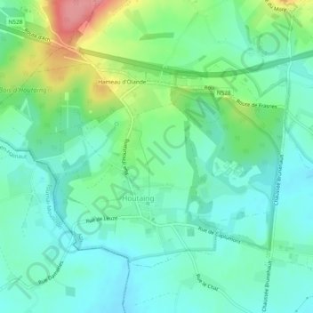
Name: Houtaing topographic map, elevation, terrain.
Location: Houtaing, Ath, Hainaut, Wallonie, Belgique (50.63313 3.65471 50.65424 3.70194)
Average elevation: 68 m
Minimum elevation: 41 m
Maximum elevation: 138 m