
Meer van Gileppe topographic map
Interactive map
Click on the map to display elevation.
About this map
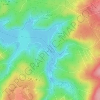
Name: Meer van Gileppe topographic map, elevation, terrain.
Location: Meer van Gileppe, Jalhay, Verviers, Luik, Wallonië, 4845, België (50.57373 5.97195 50.58968 6.00695)
Average elevation: 345 m
Minimum elevation: 297 m
Maximum elevation: 421 m
Other topographic maps
Click on a map to view its topography, its elevation and its terrain.
Baraque Michel
België > Luik > Verviers > Jalhay
Baraque Michel, Jalhay, Verviers, Luik, Wallonië, 4845, België
Average elevation: 652 m