
Amble By the Sea topographic map
Interactive map
Click on the map to display elevation.
About this map
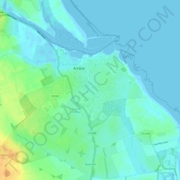
Name: Amble By the Sea topographic map, elevation, terrain.
Average elevation: 8 m
Minimum elevation: -3 m
Maximum elevation: 32 m
Other topographic maps
Click on a map to view its topography, its elevation and its terrain.
Hauxley Nature Reserve lake
United Kingdom > England > Amble > Hauxley
Hauxley Nature Reserve lake, Hauxley, Amble, Northumberland, North East England, England, United Kingdom
Average elevation: 4 m