Geolocate

Gerik topographic map

Click on the map to display elevation.

About this map

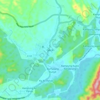
Name: Gerik topographic map, elevation, terrain.

Location: Gerik, Perak, 333000, Malaysia (5.39066 101.08964 5.47066 101.16964)

Average elevation: 163 m

Minimum elevation: 107 m

Maximum elevation: 438 m

Gear up for your next adventure:

👕UPF 50+ Sun Shirts - Essential protection against the harsh Australian sun during field work
🌬️Windbreaker Jackets - Wind protection jackets
📱Tablet Tripod Mounts - Steady platforms for viewing digital maps or taking long exposures
🪢550 Survival Paracord - Versatile cordage for gear repair and emergency lashing
🧤Thermal Hiking Gloves - Keep your hands warm and functional during high-altitude winter treks

As an Amazon Associate, this site earns from qualifying purchases at no extra cost to you.