Geolocate

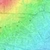
Cinambo topographic map

Click on the map to display elevation.

About this map

Name: Cinambo topographic map, elevation, terrain.

Location: Cinambo, Bandung City, West Java, Indonesia (-6.94447 107.68043 -6.91236 107.70410)

Average elevation: 677 m

Minimum elevation: 665 m

Maximum elevation: 700 m

Other topographic maps

Click on a map to view its topography, its elevation and its terrain.

Taman Lansia

Indonesia > West Java > Bandung City

Average elevation: 724 m

Taman Cibeunying

Indonesia > West Java > Bandung City > Cihapit

Average elevation: 717 m

Tegallega Park

Indonesia > West Java > Bandung City > Ciateul

Average elevation: 695 m

Taman Gesit

Indonesia > West Java > Bandung City > Lebak Gede

Average elevation: 746 m

Taman Pramuka

Indonesia > West Java > Bandung City > Cihapit

Average elevation: 707 m

Gear up for your next adventure:

🧯Animal Deterrent Spray - Safety spray for wildlife
🔋Solar Power Banks - Charge your phone and GPS using the sun while deep in the bush
🍴Titanium Spork & Cutlery - Indestructible and feather-light eating utensils
🧦Merino Wool Hiking Socks - Moisture-wicking socks to prevent blisters during long topographic surveys
🛌Sleeping Bags - Sleeping bags for outdoor camping

As an Amazon Associate, this site earns from qualifying purchases at no extra cost to you.