
Thank you for supporting this site ❤️
Make a donation
Make a donation
Gear up for your next adventure:
As an Amazon Associate, this site earns from qualifying purchases at no extra cost to you.
Shënkoll topographic map
Click on the map to display elevation.
Thank you for supporting this site ❤️
Make a donation
Make a donation
Gear up for your next adventure:
As an Amazon Associate, this site earns from qualifying purchases at no extra cost to you.
About this map
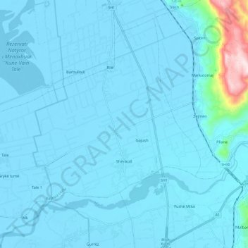
Name: Shënkoll topographic map, elevation, terrain.
Location: Shënkoll, Lezhë Municipality, Lezhë County, 0018, Albania (41.66103 19.57054 41.74292 19.68986)
Average elevation: 23 m
Minimum elevation: -6 m
Maximum elevation: 434 m
Thank you for supporting this site ❤️
Make a donation
Make a donation
Gear up for your next adventure:
As an Amazon Associate, this site earns from qualifying purchases at no extra cost to you.