
Piątnica topographic map
Interactive map
Click on the map to display elevation.
About this map
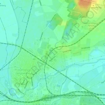
Name: Piątnica topographic map, elevation, terrain.
Location: Piątnica, Liegnitz, Woiwodschaft Niederschlesien, Polen (51.21205 16.15844 51.24218 16.20001)
Average elevation: 121 m
Minimum elevation: 110 m
Maximum elevation: 147 m
Other topographic maps
Click on a map to view its topography, its elevation and its terrain.
Pawłowice
Polen > Woiwodschaft Niederschlesien > Liegnitz
Pawłowice, Liegnitz, Woiwodschaft Niederschlesien, Polen
Average elevation: 165 m
Pątnów
Polen > Woiwodschaft Niederschlesien > Liegnitz
Pątnów, Liegnitz, Woiwodschaft Niederschlesien, Polen
Average elevation: 124 m