
Thank you for supporting this site ❤️
Make a donation
Make a donation
Gear up for your next adventure:
As an Amazon Associate, this site earns from qualifying purchases at no extra cost to you.
Oxford topographic map
Click on the map to display elevation.
Thank you for supporting this site ❤️
Make a donation
Make a donation
Gear up for your next adventure:
As an Amazon Associate, this site earns from qualifying purchases at no extra cost to you.
About this map
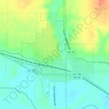
Name: Oxford topographic map, elevation, terrain.
Location: Oxford, Furnas County, Nebraska, 68967, United States (40.24298 -99.64445 40.26360 -99.62100)
Average elevation: 643 m
Minimum elevation: 623 m
Maximum elevation: 677 m
Thank you for supporting this site ❤️
Make a donation
Make a donation
Gear up for your next adventure:
🎒40L Day Hiking Backpacks - Comfortable packs with hydration support for long days exploring topographic peaks
As an Amazon Associate, this site earns from qualifying purchases at no extra cost to you.