
Whitney topographic map
Click on the map to display elevation.
About this map
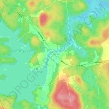
Name: Whitney topographic map, elevation, terrain.
Average elevation: 410 m
Minimum elevation: 367 m
Maximum elevation: 476 m
Other topographic maps
Click on a map to view its topography, its elevation and its terrain.
Princes Lake
Canada > Ontario > Nipissing District > South Algonquin Township
Average elevation: 467 m
Victoria Lake
Canada > Ontario > Nipissing District > South Algonquin Township
Average elevation: 407 m
Whitelily Lake
Canada > Ontario > Nipissing District > South Algonquin Township
Average elevation: 389 m